
Our work
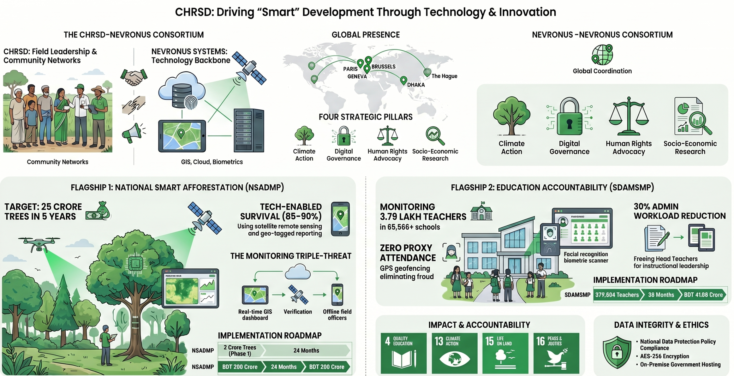
The Centre for Humanitarian Research and Social Development Foundation (CHRSD) delivers integrated, multi-sector programs aligned with Bangladesh’s national priorities and the United Nations Sustainable Development Goals (SDGs). Its work spans research, service delivery, and policy engagement to address complex development challenges.
Environmental sustainability & climate action
Afforestation, reforestation, climate adaptation, ecosystem conservation, nature-based solutions, biodiversity protection. Flagship: NSADMP (25 crore trees, GIS + satellite tracking).
Digital governance & education
Digital monitoring systems, institutional accountability, technology-enabled transparency. Flagship: SDAMSMP (proxy attendance elimination, 65,000+ government schools, 3.79 lakh teachers).
Human rights & social justice
Free legal aid for the destitute, anti-human trafficking advocacy, investigative research into corruption and financial crimes, rights-based policy advocacy.
Socio-economic research
Labor market analysis, unemployment research, anti-terror awareness, evidence-based policy development, socio-economic impact assessments.
Where we work
Interactive world map with pins on location describing what work is done there.
Programs overview
National Smart Afforestation & Digital Monitoring Program (NSADMP)
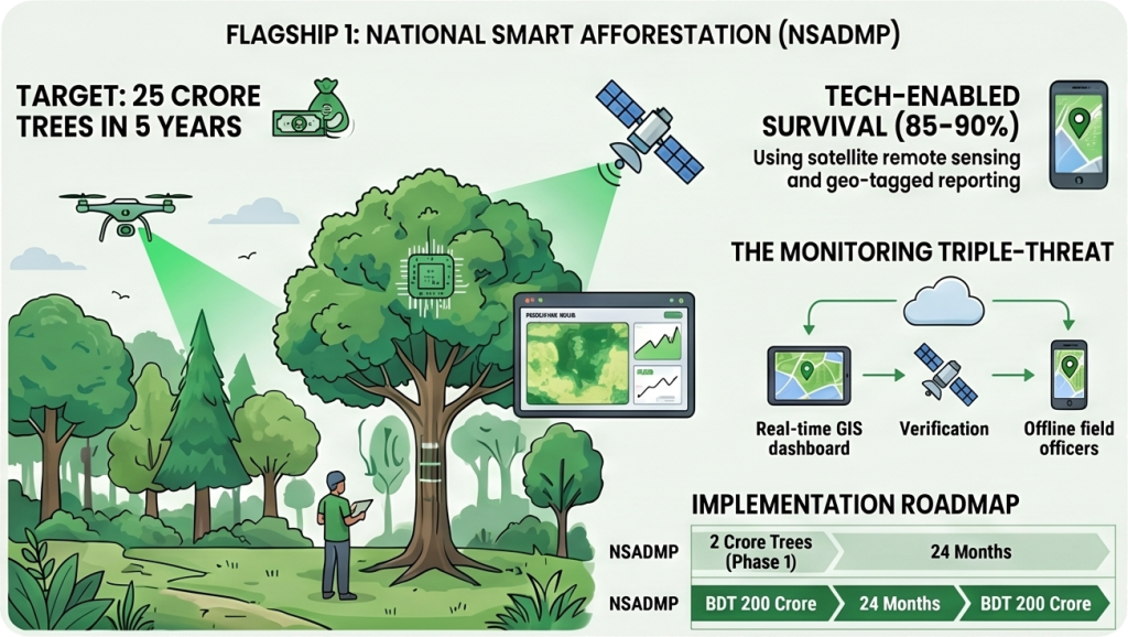
Supporting the Government of Bangladesh’s initiative to plant 25 crore trees, CHRSD manages an integrated solution combining large-scale plantation with state-of-the-art digital oversight.
• Goal: Achieving an 85–90% tree survival rate.
• Technology: Real-time GIS dashboards and NDVI satellite vegetation analysis to monitor tree health.
Smart Digital Attendance Management System (SDAMSMP):
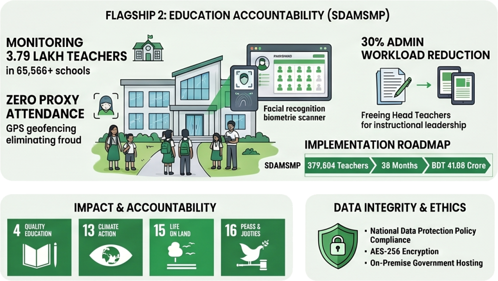
A policy-aligned digital governance initiative designed to eliminate identity fraud and improve accountability in government primary schools.
- Impact: Real-time monitoring of over 3.79 lakh teaching personnel nationwide.
- Innovation: Multi-modal biometric verification (facial recognition) and GPS-based geofencing.